


Supported platforms:
UI Languages:
Technologies:
Description:
The Degree project “Algorithms of using GIS means in the specialized tasks of managing graphical objects of forestry”. A part of the software complex developed in the Institute of Problems of Mathematical Machines and Systems of the National Academy of Sciences of Ukraine for a government production association “Укрдержліспроект” (Ukrainian state forest management production association).
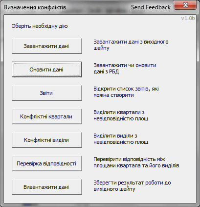
This project was used to detect conflicts in the forestry database:
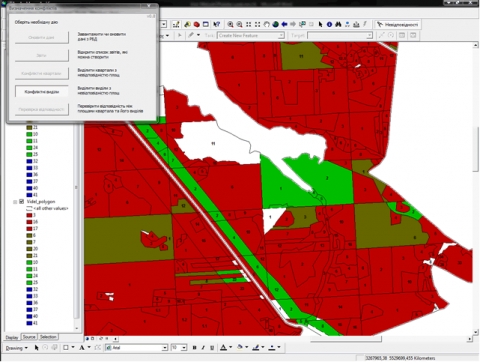
- finding sections and quarters of the forestry map that overlapped;
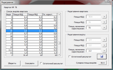
- finding sections and quarters that had different sizes recorded in the forestry database (MS SQL Server) and in the forestry map (ArcMap);
- finding sections that contained quarters, where total size of quarters wasn’t equal to the section size;
- generating HTML reports based on the detected conflicts.
My contribution:
The Degree project was developed together with my classmate: my focus was on the code and his — on the documentation. Implemented as VBA add-in for ArcMap component of ESRI ArcGIS Desktop.
Screenshots:
Attachments:
| File | Description | Size |
|---|---|---|
| Administrator's Manual (in Ukrainian) | 234.83 KB | |
| User's Manual (in Ukrainian) | 904.52 KB |